Unmanned Aerial Vehicle (UAV) Imaging

Home / Tags

Recent Inquiries

Army researchers employ various sensor platforms via air and ground-vehicle equipped with high-definition electro-optical cameras, long-wave infrared and a GPS inertial navigation system. (U.S. Army)

Thermal Imaging of Small Unmanned Aerial Vehicles (sUAVs)

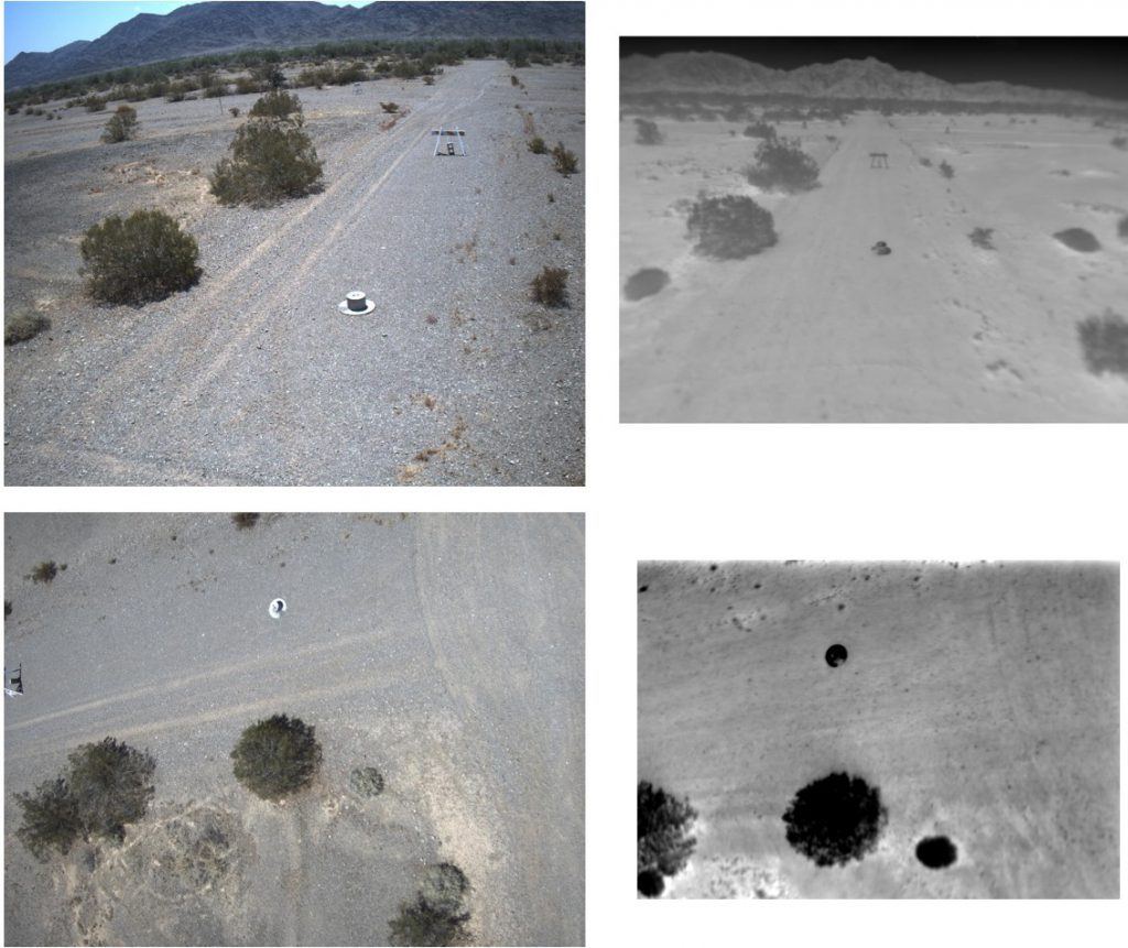
  The Defense Systems Information Analysis Center (DSIAC) was asked to locate long-wave infrared (LWIR) imagery of threat small unmanned aerial vehicles (sUAVs) to use for testing models in development.  Detecting sUAVs in flight can…

Research Efforts in Wide-Area Ocean Surveillance

  The Defense Systems Information Analysis Center (DSIAC) was asked to identify key contributors to Department of Defense research efforts in the area of wide-area ocean surveillance.  DSIAC searched open source documents for relevant information,…

Hyperspectral Imagers for Drones